The most prominent ports of Taiz closed by the Houthis
This initiative comes from journalist Taha Saleh, who carried out a simple but important task by identifying the main roads of Taiz governorate with a Google Map.
These roads link Taiz governorate with the rest of the governorates, and the Houthi militia has closed them completely since 2015.
The Houthi militia, coming from 600 km, imposes a siege on the city of Taiz, closes its main roads, bombs the city indiscriminately, and practices collective punishment of more than two million civilians in the governorate.
The Houthi militia planted insane and indiscriminate mines and explosive devices on the city’s borders, as well as snipers, spread that targeted civilians, and thousands of victims were children and women. For more, see the report “Taiz… The Siege of Death (2600 days of siege)”.
The Houthi militia is stationed in the Al-Hawban area, which is important because it includes the industrial zone of Taiz Governorate and Taiz Airport It is controlled by the Houthi militia and imposes royalties and turns the residential city into a large prison and extorts the residents from time to time.
Al-Hawban area is also the main entrance to Taiz governorate for those coming from Sana’a and Aden via the main roads (Aden-Taiz roads through Lahj governorate) and (Taiz-Sana’a road passing through Ibb, Raymah and Dhamar governorates).
Closed Ports:
Asafra – Al-Sitteen Road (Northern Exit)
The northern port includes a crossroads, including Al-Hawban Sofitel Road, the main entrance to the governorate and leading to Al-Arbaeen, Al-Rawdah, Al-Sitteen Street, and Asafra.
Asifara Al-Sitteen Road (Central Market Street) is the northern exit to the city of Taiz and connects the city with the rural districts, most notably (Sharab and Makhlaf).
It also connects to Al-Sitteen Road, which leads to Al-Hawban and the rest of the governorates. (It is considered the northern ring road to the north of Taiz).
The closed road distance is half a kilometer.
Al Rawda Street – Al Jahim
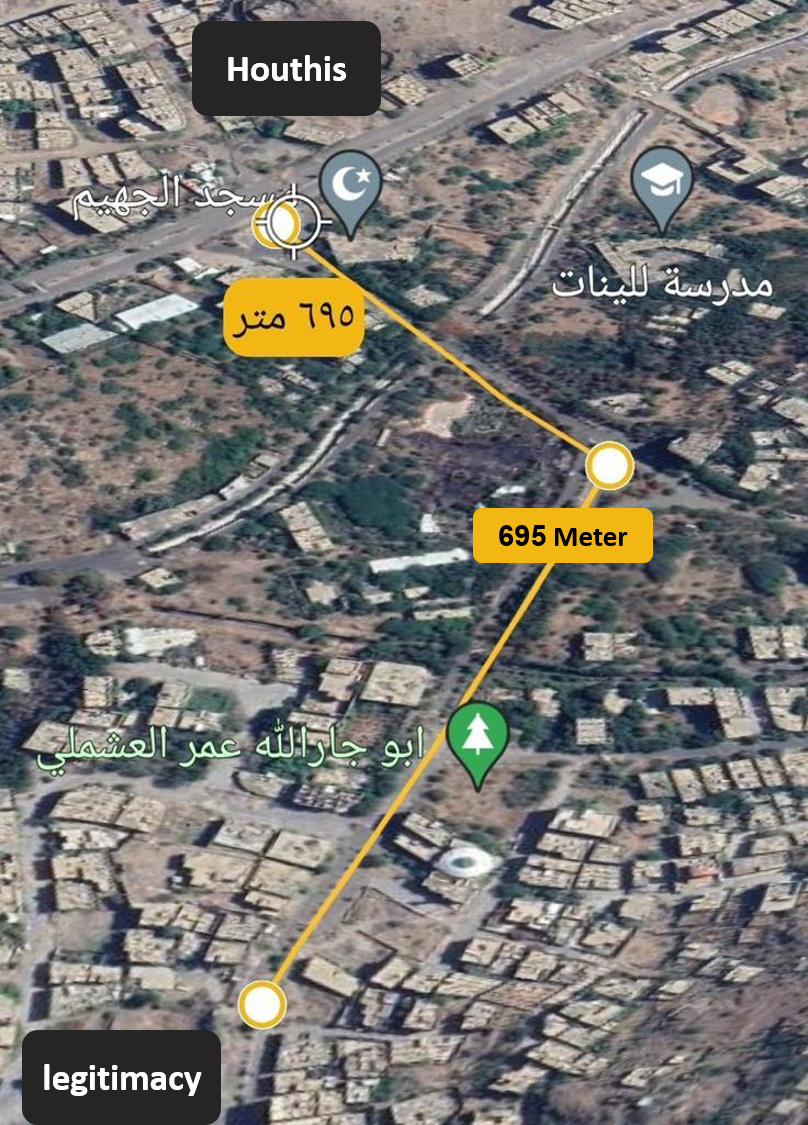
Al-Rawda Al-Juhaim Street connects the city of Taiz and the Al-Hawban area – under the control of the Houthis – and the Al-Hawban area connects the city of Taiz with the main roads of Sana’a, Ibb and Aden.
Google also shows the closed road distance of half a kilometer (695 metres).
Bir Basha Street – Ghee and Soap Factory (Western Port)
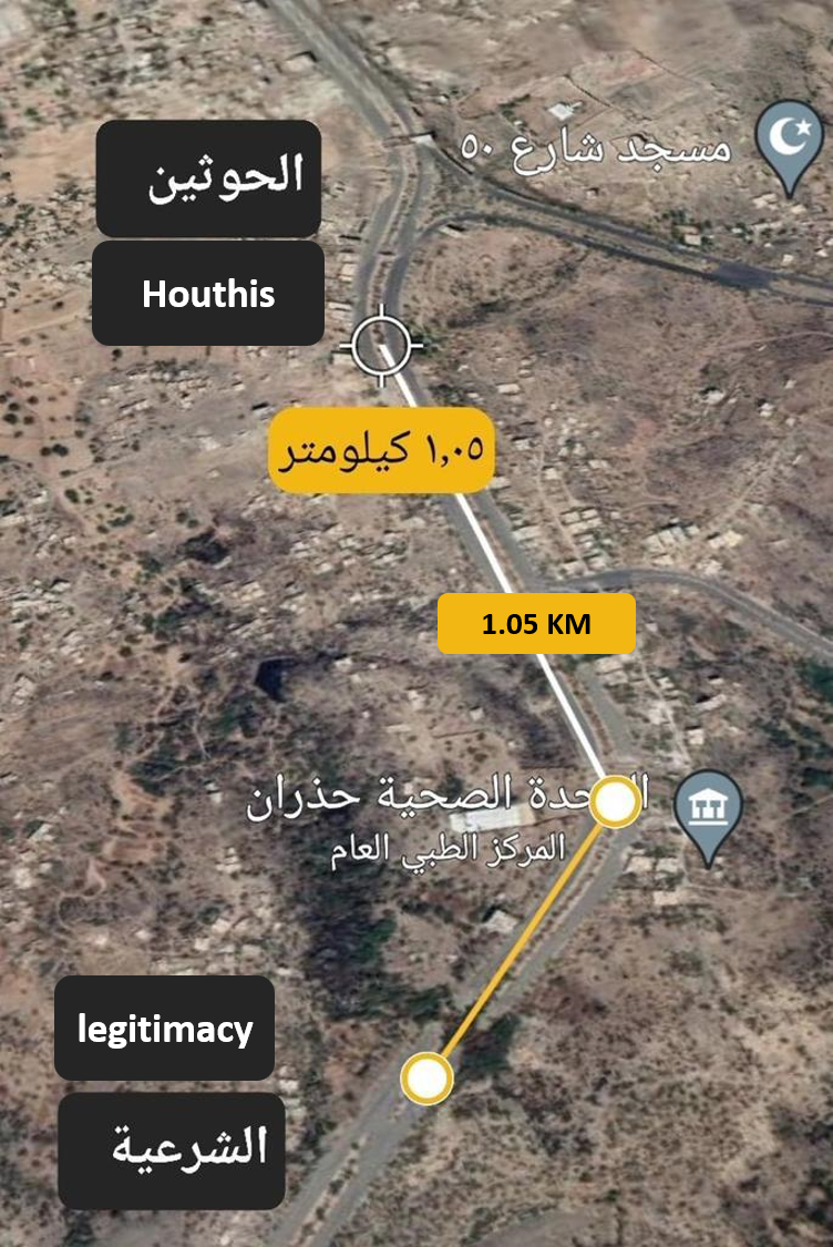
The western port is a main port for the city of Taiz, which is the link between the city of Taiz and the port of Mocha and the western districts of Taiz and Hodeidah governorate.
Google Earth shows the distance traveled by one kilometer.
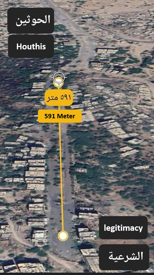
Al Qasr Round Street (East Port)
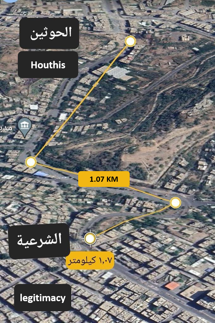
The picture shows the eastern port of Taiz, the port of the palace tour, which connects the city with Hawban, Ibb, Sana’a and Aden.
The port was the most famous and crowded before the Houthi siege,
The Qasr Tour area includes the most important sovereign institutions of Taiz, including the Republican Palace, the Central Bank, the Economic Corporation, the College of Medicine, as well as many government offices, public and private schools, and hospitals.
As Google Earth explains, the distance is only a kilometer.